Youngstown 2010 Plan
Chapter 5: Assets to Build On
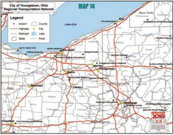
The Mahoning Valley Region including the City of Youngstown has always touted its connectivity to the national transportation network as a major locational advantage. Linkages to the region, nation and the world become evident when Youngstown is set as the focal point of the Cleveland – Pittsburgh corridor (see Map 14).
Regional Connectivity
There are two major international airports, Cleveland Hopkins International and Pittsburgh International, within 75 miles of Youngstown. Th e Akron – Canton Regional Airport provides yet another option for airline passengers. Th e Youngstown – Warren Regional Airport serves fixed base operations and charter flights. Youngstown – Warren Regional is also home to the Air Force Reserve’s 910 Tactical Air Lift Wing and houses Navy and Army Reserve facilities.
Within the same radius are two Great Lakes shipping ports at Cleveland and Erie. The Columbiana County Intermodal shipping facility at Wellsville allows access to America’s interior waterway systems via the Ohio River. Youngstown is linked to these port facilities by interstate highway and railroad access. Railroad passenger service until recently were provided by Amtrak’s Three Rivers service that ran daily between New York and Chicago. Efforts are underway to restore this service.
The Ohio Rail Commission has developed plans to establish commuter rail services between Cleveland and Pittsburgh with eight stops daily. Th e Youngstown 2010 Citywide Plan recognizes the importance of passenger/ commuter rail service as an essential component of the regional transportation linkages. One of the key projects listed by residents at the neighborhood planning meetings was maintaining the Amtrak service at the B&O station, and this plan supports daylight passenger/ commuter train service connecting Youngstown to other major cities in Ohio and other cities within the region (e.g. Chicago, Pittsburgh, Toronto, Detroit, New York). Two freight haulers, CSX and the Norfolk and Southern, connect Youngstown to the national freight rail system.
The City is also served by the Ohio Central and Youngstown and Austintown railroads, two short line haulers. Again, the Youngstown 2010 Citywide Plan recognizes the importance of continued freight service for the economic benefits of business and industry. Highway connections through Youngstown and the region to national system are exceptional. Two major east/west interstates I-80 and I-76 pass through, while I-90 and I-70 are within an hours drive. Major north/south connectors, I-79, I-77, I-71 and Ohio 11 are also within the region. City of Youngstown property taxpayers provide local financial support for the Western Reserve Transit Authority (WRTA) which provides bus service to Youngstown and surrounding communities. WRTA routes link City neighborhoods with employment, retail, financial, educational and medical facilities and opportunities inside and outside the municipal limit.
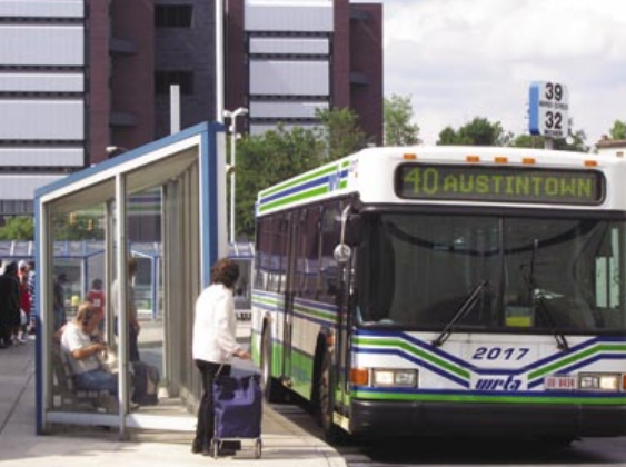
The WRTA provides linkages to public transportation systems in Trumbull County Ohio and Mercer and Lawrence Counties in Pennsylvania. Youngstown is in the process of being linked to the national hike/bike trail system. Mill Creek MetroParks operates a trail west of Youngstown that runs from Green Township in southern Mahoning County to the Trumbull County line, where it continues in various states of development along an abandoned rail line to Ashtabula. The Stavich bike trail begins southeast of Youngstown and runs from Struthers to New Castle links to trail connections to Washington. Th e missing link between these trails is through Youngstown. Th ese transportation linkages point out the importance of interconnected planning processes. Highway and other transportation planning is done on a regional level. For Mahoning and Trumbull Counties, and in certain federal transportation cases Ashtabula County and Mercer County in Pennsylvania this service is performed by Eastgate Regional Council of Governments.
Water Courses
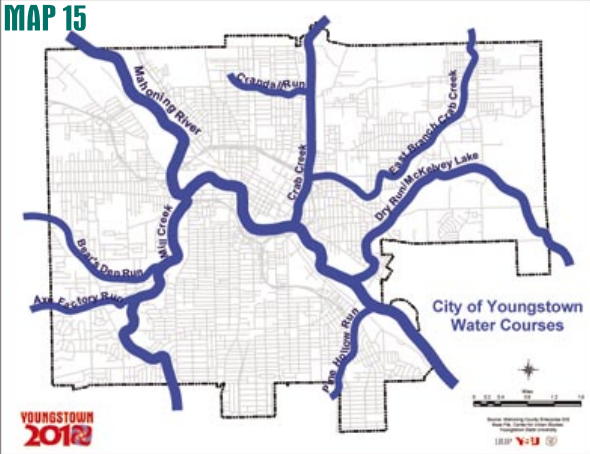
The same watercourses (see Map 15) that defined Youngstown’s quadrants and fed its industrial growth are even greater assets following deindustrialization. Th e Mahoning River restoration project and related cleanups will give the river back to the citizens of the Mahoning Valley. Communities all across the nation have found creative ways to take advantage of their water courses, economically, culturally and socially. Youngstown for the first time since the 1850s has the opportunity to use its water courses for something other than industry. Construction on Youngstown’s new convocation center, to be completed in fall of 2005, has opened river access to downtown and leaves open the possibility for a riverfront park. Th e Mill Creek Metropolitan Park District, the City and YSU are pursuing a connector trail along the river that will link the park, downtown and the university. Mill Creek Park already exists as a crown jewel in the Mahoning Valley because of Volney Rogers’ eff orts in 1891 to save a watercourse from overdevelopment. Youngstown, as it cleans and greens itself going towards 2010, has the opportunity to use its water course assets for the benefit of all its citizens and not just a few industries
Greener Networks
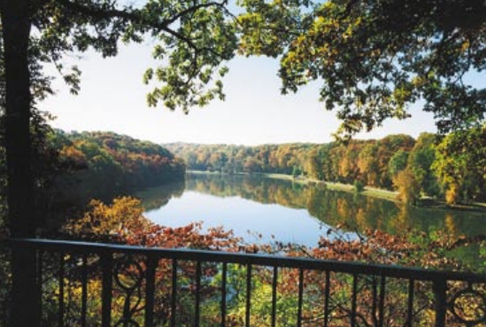
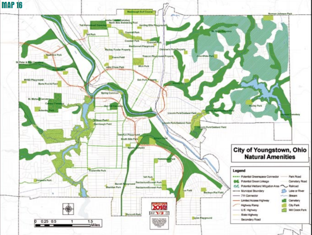
Restoring and protecting Youngstown’s watercourses leads to the establishment of a system of green networks (see Map 16). Many of the pieces of the network already exist, but most are isolated from each other. Th e neighborhood parks and metropolitan parks provide substantial benefit to those that are near them. Linking them into a green network will enhance the quality of life for the entire Mahoning Valley. When the voters of Mahoning County established the Mill Creek Metropolitan Park District, they recognized that preserving this unique asset was a regional priority, not just a city matter. Th e Mahoning River restoration project will impact the entire valley. Hiking and biking trails are being planned and constructed that link Cleveland and Pittsburgh and Ashtabula and the Ohio River. Linking Youngstown’s waterways, parks and green spaces into this regional system makes Youngstown not only cleaner and greener, but in tune with the new realities of the 21st century
Compact Core
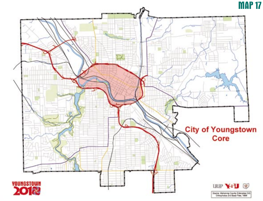
Youngstown’s compact core (see Map 17) is a remnant of the earliest days of its settlement. It was on this piece of floodplain that John Young laid out the original grid for his town. Then it was a fledgling Western Reserve agricultural hamlet, it would later grow into the bustling downtown of a thriving industrial region. Th e geography that made this place important to John Young, flat land bounded by the river and steep ridges, also kept the core from sprawling. Th e compactness and density of the infrastructure and a built environment that cannot be duplicated are assets that are incalculable.
This resource is an abridged version of the Youngstown 2010 plan. You can access the full version in pdf format below.